
Satellite image of the North York Moors in Yorkshire, England captured on December 26, 2023, by the Operational Land Imager-2…
Read More »Geography

The evolution of geospatial data, fueled by technological advancements, has led to its widespread application and the democratization of data…
Read More »
This satellite image shows Adam’s Bridge, , a natural chain of limestone shoals, stretches 48 km between Rameswaram Island in…
Read More »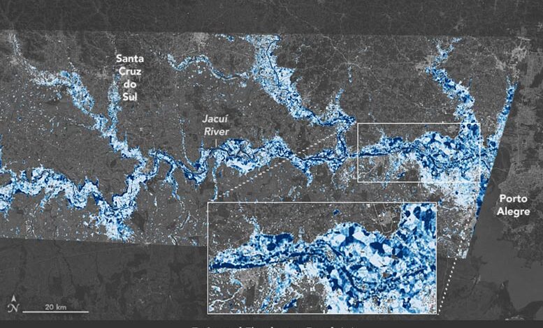
This map shows estimates of flood depth in areas west of Porto Alegre, Brazil on May 6, 2024. In 2024,…
Read More »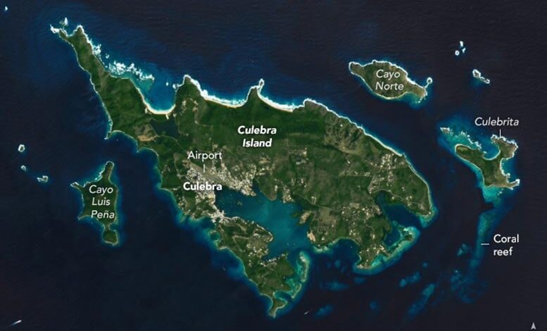
Satellite view of Culebra Island captured on February 10, 2024, by the Operational Land Imager on Landsat 8. The remote…
Read More »
Astronaut photo of the Aral Sea captured on October 17, 2023, from the International Space Station. A former island and…
Read More »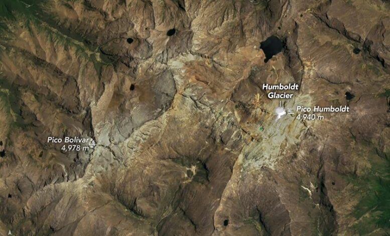
Satellite image of Venezuela’s Humboldt Glacier captured on April 28, 2015, by the Operational Land Imager on Landsat 8. Satellite…
Read More »
In early June 2024, the Corral Fire rapidly spread through grasslands near Tracy, California, fueled by strong winds and dry…
Read More »
Satellite image of Weifang Prefecture, China captured on May 7, 1987, by the Thematic Mapper on Landsat 5. Satellite image…
Read More »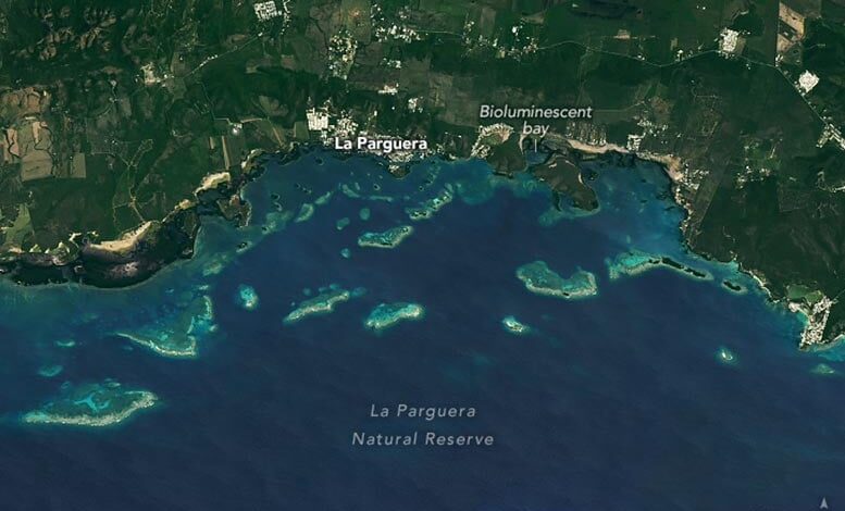
Satellite image of La Parguera Natural Reserve captured on May 15, 2024, by the Operational Land Imager on Landsat 8.…
Read More »